
Yes: a clear-looking forecast can leave the smoke question unresolved. Identify what the forecast includes, read a suitable smoke product for your region and time, and keep that information separate from what you observe through the camera.
ECCC's sky-transparency documentation gives a concrete example: smoke and other aerosols can reduce transparency, but its humidity-based astronomy forecast excludes them. That is a limitation of this particular product, not a rule about every forecast.
Start with the photography decision
Write down the subject, intended detail, and hours you can use. Decide what result would make the session worthwhile before opening another map. A useful question is whether to commit to the original composition, prepare a fallback, or keep the plan provisional until a test frame is available.
The seeing and transparency guide separates atmospheric steadiness from transmission and covers equipment checks. For this decision, the additional job is to establish what the smoke evidence actually represents.
Identify the layer before reading its color
As one regional example, the NOAA HRRR smoke viewer provides CONUS and Alaska products. Check the selected domain, model run, and valid time. A regional example is useful only when its domain covers your observing location.
The NOAA technical memo, pages 50–51, distinguishes the lowest model level from the sum across model levels. Its graphics use the following quantities:
| Graphic | Quantity described in the documentation |
|---|---|
| Near-surface smoke | Concentration at the lowest model level, roughly 8 m above ground at sea level; graphic units are µg/m³. |
| Vertically integrated smoke | Smoke summed through the model's vertical levels; graphic units are mg/m². |
Read the actual product legend and documentation rather than applying those graphic units to every raw data file. Keep each quantity in its own labeled entry; a numerical comparison between unlike units does not settle your photography decision. A low near-surface entry alone cannot establish the smoke load above that level.
Keep satellite observations in context
NOAA's VIIRS aerosol optical depth guide describes AOD as unitless, reported at 550 nm for this product. It represents a column, without a height profile or identification of aerosol type. Its reflected-sunlight retrieval is daytime only; clouds, snow, ice, and sun glint can leave gaps, and thick plumes can be classified as cloud.
Accordingly, keep a satellite observation's timestamp separate from the hours you intend to shoot. Do not interpret a missing pixel as confirmation of clear air or present a daylight observation as a forecast for the coming night.
Work through the map checks
- Open the source: retain the URL and product name, rather than an unexplained screenshot forwarded without a legend.
- Establish relevance: confirm coverage, selected layer, units, and the time labels. Keep an unconfirmed item visibly unknown.
- Compare like with like: use matching entries when reviewing a changed run. Keep observations and forecasts in separate sections. The forecast-update workflow explains those time checks in detail.
- Prepare a camera check: specify a short test sequence at the intended composition, with settings recorded so that you can understand the result later.
- Record the decision: say what evidence supports the next action and what remains unresolved. A map label alone is not a measurement of your photograph's contrast.
Choose the next useful action
These are planning choices, not numerical pass/fail thresholds for an image.
| What you have | Useful next action |
|---|---|
| A map with an unclear product name or legend | Find the original product description. Keep the decision provisional until the quantity is identified. |
| Two entries that describe different quantities | Label them separately. Resolve the disagreement in meaning before treating it as a change in conditions. |
| Information that does not cover the intended session | Find applicable information or retain the gap. Do not fill it with an assumed favorable result. |
| A test frame that does not meet your goal | Check focus, support, tracking where relevant, optics, and visible cloud before assigning a cause. Test the fallback composition or end the capture. |
Keep the original goal beside the test result. If you change the goal, write down the new one; otherwise an improvised fallback can later look like evidence that the original plan worked. The cloud-layer guide covers the separate cloud forecast.
Copy this session record
This is a blank record, with no claimed forecast, smoke event, or field result.
- Session: date, time basis, private location reference, subject, and result sought.
- Per product: source URL, selected domain and layer, legend or unit, run or observation time, and relevant valid hours.
- Limits: missing information, coverage gaps, uncertain interpretation, and questions to resolve.
- Camera check: time, composition, settings, focus/support/optics checks, and result noticed.
- Decision: original plan, fallback, or finish; evidence used, remaining uncertainty, and next check.
Bring the sky window into the plan
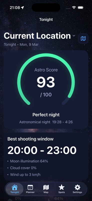
After reviewing the external products, use DarkScout to bring cloud, Moon, observing-spot, and target-window context into the plan. The Tonight image above illustrates that planning view. Keep the external smoke-product review beside those sky windows when choosing when to test the camera.
The current App Store listing offers the free iPhone app, requiring iOS 26 or later.
Give the session a useful window.
Compare Moon and cloud conditions with your observing spot and intended target.
Get DarkScout for iPhone All features free · iOS 26 or laterSources and further reading
Primary product documentation and public app information checked November 12, 2026. Product definitions remain with their publishers; this article contains no current smoke-event forecast.